Of the many Google innovations that have transformed our media world, Google Earth may be our fave. It takes a previously esoteric realm of photography — satellite imagery — and gives any internet user the power to view the planet from the sky. In doing so, it teaches us plenty about our impact on Earth.
Earlier this month, The Atlantic presented readers with a challenge: look at a series of Google Earth images and guess where on Earth they were shot. Check out a selection here, and don’t be discouraged if you get them wrong. We sucked too.
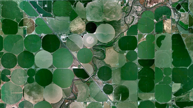
Images, from left to right:
1. Circular fields near a lake, watered with center-pivot irrigation.
2. This community lies near the intersection of seven rivers.
3. Saltwater ponds cut their way through this southerly farmland.
4. A sparse, yet noisy, neighborhood in a warm climate.
5. A lonely vessel. Good luck with that one!
6. A contrast of wet and dry near the Atlantic Ocean.
7. Terraced rice paddies. Tending these fields must be seriously hard.
Head over to The Atlantic to see the answers.